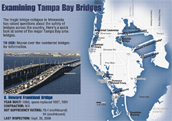
 Below is a roundup of links to interesting infographics, maps, databases and other types of interactive coverage of the Minneapolis bridge collapse. Also, IRE has an excellent set of bridge-related resources.
(NOTE: I’ve updated the list a few times with more links from people who’ve written in; many thanks.)
New York Times
Interactive graphic with step-by-step look at how the collapse occurred
USAToday
Map of the collapse site and a historical look at other major bridge collapses
Washington Post
Interactive graphic analyzing each portion of the destruction
St. Paul Pioneer Press
Community-contributed photos | Audio slideshow
Miami Herald
Interactive mashup map of South Florida bridges in poor condition
Palm Beach Post
Searchable database of Florida bridges
Cleveland Plain-Dealer
Interactive map of state showing deficient bridges by county | Searchable database of all Ohio bridges | Interactive state-by-state map of U.S. showing deficient bridges
Des Moines Register
Searchable database of Iowa bridges
Orlando Sentinel
Interactive mashup map of Central Florida bridges in poor condition
The Oregonian
Interactive mashup map of structurally deficient bridges in Oregon
St. Petersburg Times
Flash graphic with map, statistics and bridge construction graphics
MSNBC
Interactive Flash map of state-by-state deficient bridge tallies
Wikipedia
Community-edited article about the bridge
Legacy.com
Guest book for Minneapolis bridge victims
Florida Today
GIS-based map of all Brevard County bridges
Wow, that Miami Herald graphic is a really nice use of Google Maps! I like it!
we have loads more multimedia online at http://www.twincities.com and http://www.pioneerpressphotos.com
Nice list, Danny. Thanks!